Discover the Pacific islands from the lens of a drone
 For some years now, photography and cinematography have become leisure activities accessible to all. Indeed, the creation of audiovisual content has become an activity available to everyone thanks to the arrival of technological innovations open to everyone such as the « GoPro » camera. This trend intensified with the arrival of drones; a new device offering unlimited possibilities to amateur videographers.
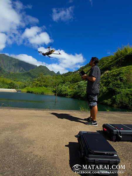 Drones are “strange” flying objects operated by remote control that can carry a camera. They revolutionized the audiovisual sector. Originally, drones were created for military surveillance in war zone but its use has been quickly and easily gone to a higher level. Nowadays, they fly over our head to immortalize stunning images of our landscapes. A drone may possess 4 to 8 rotors. The most powerful machines fly up to 660 ft in altitude. These high-tech products are now accessible to everyone thanks to affordable rates and easy user interface.
French Polynesia has not escaped this global “drone” trend. Thus, some Polynesian audiovisual production companies are now specialized in aerial shots assisted via drone. The best-known are Matarai Photography (meaning « the eye in the sky » in Tahitian language)  and the TahitiFlyShoot team that includes the famous sports photographer, Tim McKenna.
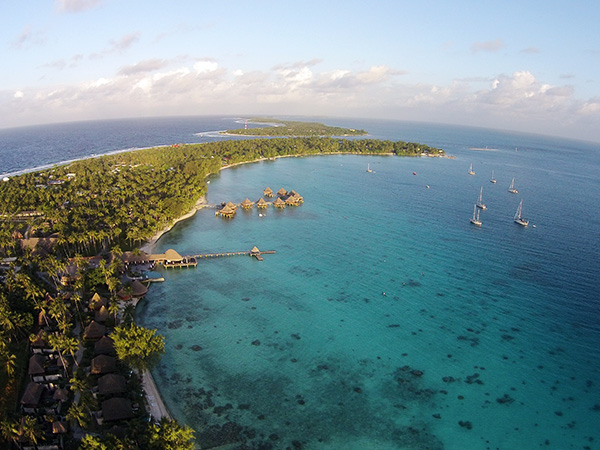
The islands of Tahiti offer perfect locations for drone flights and aerial videography. Indeed, the drone lets us discover another viewpoint on our islands. The altitude reached by drones allows us to appreciate the myriad shades of our turquoise blue lagoon, the bright green of our vegetation and the deep blue of the Polynesian sky. Viewed from the air, all the beauty of our fauna and flora reveals itself and enthralls the viewer. We can observe the wild aspect of our lands on pictures taken by drone. French Polynesia territory offers unlimited landscapes for drone’s flights; high islands as well as atolls (islet).
These “flying cameras” allow us rediscovering familiar landscapes with a fresh eye. Between piloting and photography, drones highlight the beauty of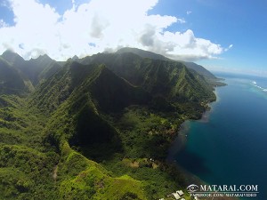 our natural resources. It is the reason why these new aerial images are used more and more by resorts, excursion service providers as well as the tourism stakeholders for their communication campaigns. Drones are a new tool well used for promoting the destination of Tahiti and her Islands.
Discover the last video clip shared by the GIE Tahiti Tourism and enjoy the aerial images produced by Matarai and TahitiFlyShoot companies.
NOTE : If you intend on investing in your own drone, be sure to respect the rules and regulations applicable in your country.